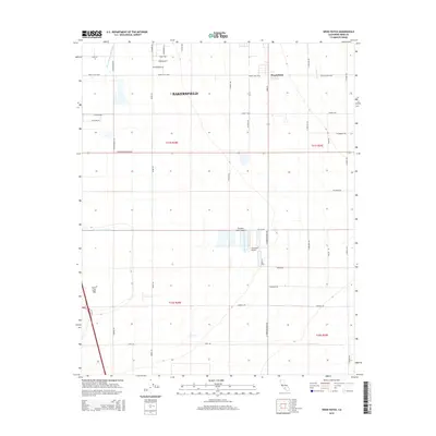
2015 Map of Weed Patch
USGS Topo · Published 2015About this map
The community of Weed Patch and the southern reaches of Bakersfield anchor this 2015 survey of Kern County's agricultural heartland. This landscape is defined by its sophisticated water management systems, including the Central Br Kern Island Canal, the E Side Canal, and the Kern Island Drain, which transformed the arid basin into a productive valley. A significant portion of the southwestern quadrant is occupied by the dry Kern Lake Bed, a remnant of the region's historical hydrology before intensive irrigation and reclamation projects redirected the local flow.
Find a feature on this map
43 named features on this map. Tap any name to fly to it.
Don’t see what you’re looking for? This feature index may not catch every label — zoom into the map to look around manually.
Map Details
Editions of this 2015 Weed Patch Map
This is the sole edition of this map. No revisions or reprints were ever made.
Other maps of this area

1910 · Buena Vista Lake
USGS Topo · 1:125,000

1912 · Buena Vista Lake
USGS Topo · 1:125,000

1914 · Caliente
USGS Topo · 1:125,000

1929 · Fairfax School
USGS Topo · 1:31,680

1930 · Weed Patch
USGS Topo · 1:31,680

1930 · Arvin
USGS Topo · 1:31,680

1930 · Conner
USGS Topo · 1:31,680

1931 · West of Tejon Hills
USGS Topo · 1:31,680

1931 · Edison
USGS Topo · 1:31,680

1931 · Tejon Hills
USGS Topo · 1:31,680