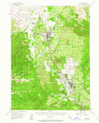
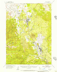
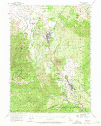
1954 Map of Weed
USGS Topo · Published 1962About this map
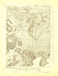
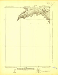
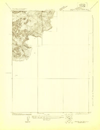
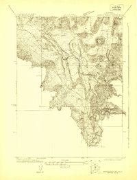
Weed and the surrounding high-country timber and rail corridor define this mid-century survey of the Shasta National Forest. The landscape is dominated by the massive profile of Black Butte and the northern slopes of Mt Shasta, where the Southern Pacific railroad winds through the canyon following the North Fork Sacramento River. Industrial features like the Log Pond and Sawmill Curve near Weed reflect the region's historical reliance on the lumber industry, while the local infrastructure includes a High Sch, a Fish Hatchery, and a Radio Tower KWSD.
Find a feature on this map
68 named features on this map. Tap any name to fly to it.
Don’t see what you’re looking for? This feature index may not catch every label — zoom into the map to look around manually.
Map Details
Editions of this 1954 Weed Map
3 editions found
Other maps of this area

1886 · Shasta
USGS Topo · 1:250,000

1894 · Shasta
USGS Topo · 1:250,000

1921 · Shasta Valley Sheet No 7
USGS Topo · 1:24,000
1921 · Shasta Valley Sheet No 1
USGS Topo · 1:24,000
1922 · Shasta Valley Sheet No 10
USGS Topo · 1:24,000
1922 · Shasta Valley Sheet No 1 S
USGS Topo · 1:24,000
1922 · Shasta Valley Sheet No 9
USGS Topo · 1:24,000
1922 · Shasta Valley Sheet No 8
USGS Topo · 1:24,000

1923 · Sawyers Bar
USGS Topo · 1:125,000

1931 · Etna
USGS Topo · 1:96,000