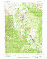
1954 Map of Weed
USGS Topo · Published 1971About this map
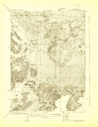
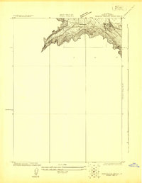
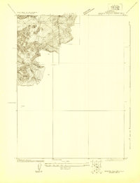
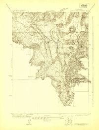
Mt Shasta and the timber-focused economy of the mid-20th century dominate this landscape, where the Southern Pacific railroad snakes through the Shasta Valley to support the lumber operations at Weed. The presence of a massive Log Pond and Sewage Disposal facilities near the town center reflects the industrial processing required for the region's heavy timber harvest. To the south, the topography rises sharply toward the volcanic landmark of Black Butte and the Trinity Mountains, where high-elevation landmarks like Mt Eddy and the Deadfall Lakes sit within the Shasta National Forest. Settlement patterns follow the rail line and the Pacific Highway, connecting smaller locales such as Edgewood, Igerna, and Mott. This survey also documents local aviation and conservation infrastructure, including the Mott Airport and a Fish Hatchery near Sisson Slough, providing a detailed look at Siskiyou County infrastructure before later modernization.
Find a feature on this map
65 named features on this map. Tap any name to fly to it.
Don’t see what you’re looking for? This feature index may not catch every label — zoom into the map to look around manually.
Map Details
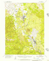
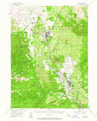
Editions of this 1954 Weed Map
3 editions found
Other maps of this area

1886 · Shasta
USGS Topo · 1:250,000

1894 · Shasta
USGS Topo · 1:250,000

1921 · Shasta Valley Sheet No 7
USGS Topo · 1:24,000
1921 · Shasta Valley Sheet No 1
USGS Topo · 1:24,000
1922 · Shasta Valley Sheet No 10
USGS Topo · 1:24,000
1922 · Shasta Valley Sheet No 1 S
USGS Topo · 1:24,000
1922 · Shasta Valley Sheet No 9
USGS Topo · 1:24,000
1922 · Shasta Valley Sheet No 8
USGS Topo · 1:24,000

1923 · Sawyers Bar
USGS Topo · 1:125,000

1931 · Etna
USGS Topo · 1:96,000