
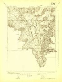
1922 Map of Shasta Valley Sheet No 9
USGS Topo · Published 1922About this map
Moffit Mill stands at the northern edge of this high-altitude landscape in the early 1920s, a period when the Klamath-Shasta Valley Irrigation District and the U.S. Reclamation Service were actively surveying the region's complex topography. This specific sheet, produced as an advance copy subject to correction, focuses on the elevation contours of the terrain surrounding Weed, capturing a moment when industrial and agricultural water interests were shaping the development of the valley. The map documents a singular industrial point in a landscape primarily defined by its extreme relief and drainage patterns, providing a precise record of local geography as it was understood before later 20th-century developments altered the infrastructure.
Find a feature on this map
2 named features on this map. Tap any name to fly to it.
Don’t see what you’re looking for? This feature index may not catch every label — zoom into the map to look around manually.
Map Details
Editions of this 1922 Shasta Valley Sheet No 9 Map
This is the sole edition of this map. No revisions or reprints were ever made.
Other maps of this area

1886 · Shasta
USGS Topo · 1:250,000

1894 · Shasta
USGS Topo · 1:250,000

1921 · Shasta Valley Sheet No 7
USGS Topo · 1:24,000

1922 · Shasta Valley Sheet No 10
USGS Topo · 1:24,000
1922 · Shasta Valley Sheet No 8
USGS Topo · 1:24,000

1934 · Macdoel
USGS Topo · 1:96,000

1935 · Dunsmuir
USGS Topo · 1:125,000

1941 · Macdoel
USGS Topo · 1:125,000

1948 · Weed
USGS Topo · 1:250,000

1950 · Weed
USGS Topo · 1:250,000