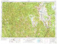
1958 Map of Weed
USGS Topo · Published 1977About this map
Mount Shasta dominates the eastern horizon of this Northern California survey, which traces the complex geography of the Siskiyou Mountains and Marble Mountains. The region is defined by its deep river valleys, where the Klamath River and Scott River provide a lifeline for gold-rush era settlements like Sawyers Bar, Callahan, and Fort Jones. To the west, the Hoopa Valley Indian Reservation and Six Rivers National Forest encompass the drainage of the Trinity River, while the eastern corridor follows the Southern Pacific railroad through Weed and Dunsmuir.
Find a feature on this map
195 named features on this map. Tap any name to fly to it.
Don’t see what you’re looking for? This feature index may not catch every label — zoom into the map to look around manually.
Map Details
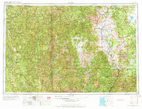
Editions of this 1958 Weed Map
3 editions found

Other maps of this area

1886 · Lassen Peak
USGS Topo · 1:250,000

1886 · Modoc Lava Bed
USGS Topo · 1:250,000

1886 · Shasta
USGS Topo · 1:250,000

1889 · Klamath
USGS Topo · 1:250,000

1890 · Red Bluff
USGS Topo · 1:250,000

1891 · Ashland
USGS Topo · 1:250,000

1892 · Modoc Lava-Bed
USGS Topo · 1:250,000

1892 · Lassen Peak
USGS Topo · 1:250,000

1893 · Ashland
USGS Topo · 1:250,000

1894 · Lassen Peak
USGS Topo · 1:250,000