Old Maps of Josephine County, Oregon
Explore 324 old maps of Josephine County, spanning from 1904 to today. These high-resolution historic maps reveal how streets, neighborhoods, landmarks, and natural features evolved over time — perfect for genealogy, metal detecting, research, and local history exploration.
What you can do with these maps:
- See how Josephine County changed over time: Compare historical maps to modern-day views to trace roads, homesites, rail lines & more.
- View detailed metadata: Each map includes creators, publishers, year, scale, and archive source.
- Overlay maps with satellite & LiDAR: Visualize the past alongside modern tools to explore terrain & human change.
- Trusted historical sources: Maps sourced from the USGS, Library of Congress, and other archives.
- Access maps your way: View online, download high-res files, or order prints for personal or research use.
Start exploring old maps of Josephine County to uncover forgotten places, hidden landmarks, and the deep history beneath your feet.
Josephine County, OR maps
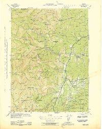
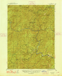
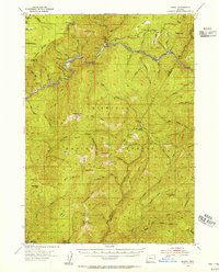
(324)- 1904 Map of Riddle
 1904 Riddle1904 Print · USGSSouthern Oregon's mining and railroad corridor is captured here at the start of the twentieth century. Genealogists can trace family footprints through early settlements like Riddles and Galesville or locate specific claims like the Placer Star Mine.5 unique versions available
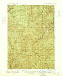
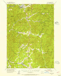
 - 1908 Map of Grants Pass
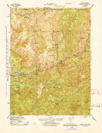
 1908 Grants Pass1908 Print · USGSThe Rogue River valley and Siskiyou Mountains are shown here during a peak era of mineral extraction and rail expansion. Researchers can trace historic claims like the Granite Hill Mine or find early settlements such as Woodville and Wilderville before modern development altered the landscape.5 unique versions available
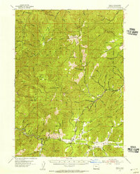
 - 1914 Map of Seiad, 1957 Print
 1914 Seiad1957 Print · USGSSiskiyou County's rugged borderlands are documented here just before the First World War, showing a landscape of remote mines and river settlements. Genealogists and historians can trace family outposts like Johnsons Dairy, old schoolhouses, and active mining works such as the Blue Ledge Mine.
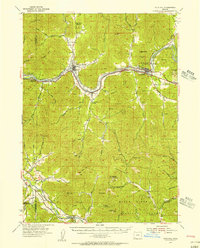
 - 1917 Map of Kerby, 1927 Print
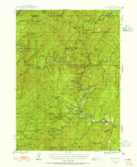
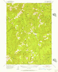
 1917 Kerby1927 Print · USGSSouthern Oregon's mining and timber country is documented here during the early twentieth century, showing the Illinois River basin at its industrial peak. Genealogists can trace family homesteads and local institutions through Kerby, Selma, and rural schools like Spence School.3 unique versions available
 - 1918 Map of Kerby
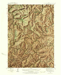
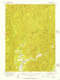
 1918 Kerby1918 Print · USGSJosephine County in the years before the Great War was a center of mountain mining and early forestry. Genealogists and historians can trace the pioneer footprints of Waldo, Kerby, and Takilma, alongside remote operations like the Queen of Bronze Mine and Eureka Mine.2 unique versions available
 - 1922 Map of Preston Peak
 1922 Preston Peak1922 Print · USGSThe California-Oregon borderlands are mapped here just before the era of modern highway expansion, showing a network of remote river bars and mountain ranches. Trace the locations of early outposts like Gasquet Adams Sta, the Cleopatra Mine, and Terwer School.5 unique versions available
 - 1922 Map of Seiad
 1922 Seiad1922 Print · USGSSiskiyou County's rugged mining and timber country is captured here during the early twentieth century. Researchers can trace historic river crossings like Gordons Ferry, remote schools such as Nolton School, and active gold operations including the Siskiyou Mine.4 unique versions available
 - 1945 Map of Kerby
 1945 Kerby1945 Print · USGSJosephine County at the close of the war shows a landscape of deep-woods mining and early forest management. Genealogists and historians can trace family roots through labels for Dryden Sch, the Hancock Ranch, and the early community at Takilma.
 - 1945 Map of Gasquet
 1945 Gasquet1945 Print · USGSThe northern California mountains near the Oregon border are shown here during the mid-1940s, a period defined by remote mining and forest service outposts. Genealogists and historians can trace family locations and old worksites like Adams Station, the Tyson Chrome Co Mine, and the Lee Brown Ranch.
 - 1946 Map of Galice, 1955 Print
 1946 Galice1955 Print · USGSSouthern Oregon's Rogue River corridor is documented here in the mid-forties, highlighting a period when gold mining and forest service outposts defined the region. Researchers can trace the heritage of local claims like the Almeda Mine and settlements such as Galice and Rand.4 unique versions available
 - 1946 Map of Dutchman Butte, 1958 Print
 1946 Dutchman Butte1958 Print · USGSThe high timber country of Douglas and Josephine counties is captured here in the mid-1940s during the height of fire-watch forestry. Researchers can trace the early Pacific Trail and locate isolated outposts like the Dutchman Butte Lookout and Bradford Warden Sta.6 unique versions available
 - 1948 Map of Galice
 1948 Galice1948 Print · USGSThe Rogue River canyon in the late 1940s reveals a landscape defined by remote forest camps and a storied mining history. Genealogists and historians can trace the locations of the Benton Mine, the riverside settlement of Galice, and Rainie Falls.2 unique versions available
 - 1948 Map of Dutchman Butte
 1948 Dutchman Butte1948 Print · USGSThe Oregon backcountry of Douglas and Curry counties is captured here in the late 1940s, showing a landscape of forest management and rail transport. Researchers can locate early fire lookouts and stations like Dutchman Butte Lookout and Bradford Warden Sta alongside the Southern Pacific line.2 unique versions available
 - 1948 Map of Weed, 1950 Print
 1948 Weed1950 Print · USGSNorthern California and Southern Oregon are captured here during the post-war era, documenting the mountain-and-valley economies of the Klamath and Cascade ranges. Trace the legacy of local mining and timber at the King Solomon Mine, find old schools like Siskiyou County School, and follow the historic Southern Pacific RR route.2 unique versions available
 - 1950 Map of Weed
 1950 Weed1950 Print · USGSSiskiyou County and the surrounding Klamath mountains appear in the mid-century before extensive modern development. Genealogists and local historians can locate remote outposts like the Lee Brown Ranch and the specialized settlement of Darlingtonia.
 - 1951 Map of Gasquet, 1953 Print
 1951 Gasquet1953 Print · USGSDel Norte County's rugged mining and timber country is captured here during the early fifties, centering on the Smith River corridor. Genealogists and researchers can trace local operations like the Morrell Placer Mine, locate remote outposts like Elk Camp, and find early settlements at Gasquet and Darlingtonia.5 unique versions available
 - 1954 Map of Coos Bay
 1954 Coos Bay1954 Print · USGSCoastal Oregon at mid-century shows a landscape of timber and tides, from the river ports to the edge of the Pacific. Researchers can trace family roots through coastal schools like Beachview School or follow the Southern Pacific RR through Reedsport and Coos Bay.
 - 1954 Map of Cave Junction, 1956 Print
 1954 Cave Junction1956 Print · USGSThe Illinois River valley in Southern Oregon comes alive in the mid-fifties, showing a landscape of mining camps and timber towns before modern development. Researchers can trace family sites at Takilma, locate the old Waldo townsite, or find historic workings like the Esterly Mine.3 unique versions available
 - 1954 Map of Oregon Caves, 1956 Print
 1954 Oregon Caves1956 Print · USGSThe Siskiyou Mountains come alive in the mid-1950s, showing a landscape defined by high-altitude mining and the early infrastructure of Oregon Caves National Monument. Genealogists and historians can trace old homesteads and mining sites like Browntown, Watts Cem, and Tiger Springs California Bar.3 unique versions available
 - 1954 Map of Marial, 1956 Print
 1954 Marial1956 Print · USGSThe Rogue River canyon in the 1950s is shown here as a remote landscape of forest camps and river bars. Genealogists and historians can trace old trails and lookouts including Dutch Henry Trail, Marial, and Paradise Bar Landing Field.4 unique versions available
 - 1954 Map of Glendale, 1956 Print
 1954 Glendale1956 Print · USGSThe timber and mining country of Douglas and Josephine Counties is captured here in the mid-fifties, centered on the Southern Pacific line. You can trace the lineage of local claims at the Greenback Mine and Steam Beer Placer or find the sites of the Merlin Sanitarium and Aman Ranch.3 unique versions available
 - 1954 Map of Selma, 1956 Print
 1954 Selma1956 Print · USGSJosephine County mountain life in the mid-fifties centered on timber and mining outposts along the Redwood Highway. Trace family roots at Deer Creek Cemetery or locate old industrial sites like Spaulding Mills (Site) and the Murray Mine.4 unique versions available
 - 1954 Map of Gold Hill, 1956 Print
 1954 Gold Hill1956 Print · USGSSouthern Oregon's river valleys and mining districts are captured here in the mid-1950s, showing the intersection of transit and timber. Genealogists and historians can trace the foundations of Rogue River and Gold Hill, finding landmarks like Log Town Cem and the Oregon Belle Mine.4 unique versions available
 - 1954 Map of Chetco Peak, 1956 Print
 1954 Chetco Peak1956 Print · USGSThe Siskiyou high country in the mid-1950s shows a wilderness marked by ranger cabins and fire lookouts along the Curry and Josephine county line. Researchers can locate remote outposts like Madstone Cabin and trace the old routes to Chetco Peak or Cottonwood Camp.4 unique versions available
 - 1954 Map of Wimer, 1956 Print
 1954 Wimer1956 Print · USGSSouthern Oregon's timber and mountain country comes to life in the mid-fifties as the forest service network expands. Local historians can trace early rural life at Wimer, the Evans Valley Sch, and remote outposts like Salt Creek Guard Sta.3 unique versions available
Showing maps 1-25 of 324
Top cities of Josephine County
Frequently asked questions
- What are the different types of historical maps available for Josephine County?
- What is the oldest map of Josephine County?
- Where can I purchase historical maps of Josephine County for my home or office?
- Where can I download high-res historical maps of Josephine County?
- Are there historical topographic maps available for Josephine County?
- Is there historical aerial imagery available for Josephine County?
- Where are historical maps of Josephine County sourced from?