Loading...
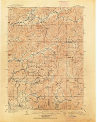
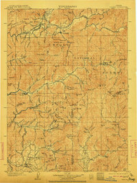
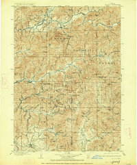
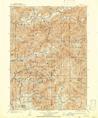
Loading map...1904 Map of Riddle
USGS Topo · Published 1948About this map
The Umpqua River and its numerous tributaries dominate this early 20th-century landscape, providing the lifeblood for settlements like Riddle and Canyonville. As the Southern Pacific RR snakes through the valleys near Glendale and Leland, it connects the region's isolated communities to a burgeoning timber and mineral economy. The terrain is marked by high-altitude vantage points like Silver Butte Lookout and Red Mtn Lookout, which overlook the vast expanse of the Umpqua National Forest.
Find a feature on this map
167 named features on this map. Tap any name to fly to it.
Don’t see what you’re looking for? This feature index may not catch every label — zoom into the map to look around manually.
Map Details
Date Portrayed1904
Date Published1948
PublisherU.S. Geological Survey
Map TypeTopographic
Scale1:125,000
Physical Dimensions16.6 x 20.9 inches
Editions of this 1904 Riddle Map
5 editions found

Historical Maps of Myrtle Creek Through Time
1 maps found
Featured Locations
Source Details
SourceU.S. Geological Survey
CopyrightPublic Domain