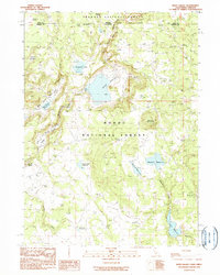
1990 Map of Weed Valley
USGS Topo · Published 1990About this map
Weed Valley sits at the intersection of the Fremont National Forest and Modoc National Forest, straddling the border of Lake County, Oregon, and Modoc County, California. This 1990 provisional survey documents a landscape defined by seasonal water management and grazing infrastructure, anchored by the Weed Valley Ranch and the Crowder Flat Station. The terrain is characterized by high-elevation flats like Buchanan Flat and Lims Flat, which are interspersed with numerous small reservoirs, including the curiously named Baseball Reservoir and the Picnic Grove Reservoir. These features, along with a network of springs such as Buckhorn Spring and Triple Spring, reflect the vital importance of water resources in this high-desert forest environment. The map also records industrial and geographical landmarks like Kellogg Mountain and a local Gravel Pit.
Find a feature on this map
29 named features on this map. Tap any name to fly to it.
Don’t see what you’re looking for? This feature index may not catch every label — zoom into the map to look around manually.
Map Details
Editions of this 1990 Weed Valley Map
This is the sole edition of this map. No revisions or reprints were ever made.
Other maps of this area

1886 · Alturas
USGS Topo · 1:250,000

1892 · Alturas
USGS Topo · 1:250,000

1954 · Alturas
USGS Topo · 1:250,000

1955 · Klamath Falls
USGS Topo · 1:250,000

1958 · Alturas
USGS Topo · 1:250,000

1958 · Klamath Falls
USGS Topo · 1:250,000

1960 · Strawberry Butte
USGS Topo · 1:62,500

1962 · Alturas
USGS Topo · 1:250,000

1962 · Steele Swamp
USGS Topo · 1:62,500

1962 · South Mountain
USGS Topo · 1:62,500