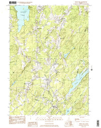
1982 Map of Weeks Mills
USGS Topo · Published 1983About this map
Erskine Academy and the surrounding rural villages of Kennebec County define this interior Maine landscape during the early 1980s. The Sheepscot River and its West Branch carve through the center of the terrain, providing a natural corridor for early development at Coopers Mills and Windsorville. The map captures a moment when the regional economy was reflected in numerous gravel pits and the prominent Windsor Fairgrounds, which served as a focal point for the community. Settlement patterns are distributed across a series of small crossroads including North Windsor, South Windsor, and Halls Corner. Genealogists will find a high density of small family-named burying grounds such as Chadwick Hill Cem, Deer Hill Cem, and Coburn Cem, while the location of Windsor Station preserves the history of rail access in the Sheepscot valley. Large water bodies like Threemile Pond and Long Pond anchor the western and eastern boundaries respectively.
Find a feature on this map
55 named features on this map. Tap any name to fly to it.
Don’t see what you’re looking for? This feature index may not catch every label — zoom into the map to look around manually.
Map Details
Editions of this 1982 Weeks Mills Map
2 editions found
Other maps of this area

1893 · Vassalboro
USGS Topo · 1:62,500

1893 · Wiscasset
USGS Topo · 1:62,500

1898 · Vassalboro
USGS Topo · 1:62,500

1913 · Waldoboro
USGS Topo · 1:48,000

1915 · Waldoboro
USGS Topo · 1:62,500

1916 · Liberty
USGS Topo · 1:62,500

1941 · Waldoboro
USGS Topo · 1:62,500

1941 · Vassalboro
USGS Topo · 1:62,500

1942 · Liberty
USGS Topo · 1:62,500

1943 · Vassalboro
USGS Topo · 1:62,500