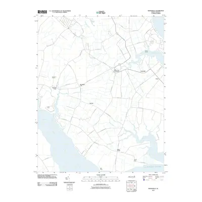
2010 Map of Weeksville
USGS Topo · Published 2010About this map
Almemarle Sound defines the southern reach of this coastal landscape, where the Little River and numerous tidal creeks carve through the Pasquotank County lowlands. The area is characterized by small, established communities and family-named junctions such as Old Weeksville, Weeksville, and Listers Corner. Agriculture and local transport dominate the interior, with a network of rural roads like Dry Ridge Rd and Peartree Rd connecting the scattered settlements of Four Forks and Winslow.
Find a feature on this map
61 named features on this map. Tap any name to fly to it.
Don’t see what you’re looking for? This feature index may not catch every label — zoom into the map to look around manually.
Map Details
Editions of this 2010 Weeksville Map
This is the sole edition of this map. No revisions or reprints were ever made.
Other maps of this area

1906 · Hertford
USGS Topo · 1:62,500

1940 · Hertford
USGS Topo · 1:62,500

1940 · Wade Point
USGS Topo · 1:62,500

1940 · South Mills
USGS Topo · 1:62,500

1943 · Wade Point
USGS Topo · 1:62,500

1948 · Wade Point
USGS Topo · 1:62,500

1948 · Elizabeth City
USGS Topo · 1:62,500

1952 · South Mills
USGS Topo · 1:62,500

1953 · Norfolk
USGS Topo · 1:250,000

1982 · Nixonton
USGS Topo · 1:24,000