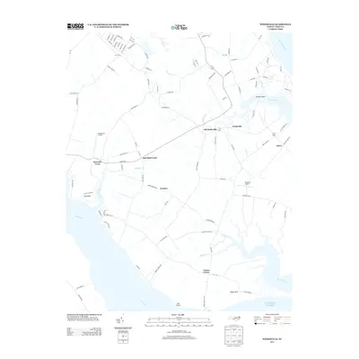
2013 Map of Weeksville
USGS Topo · Published 2013About this map
Newbegun Cr and the Pasquotank River define the watery landscape of this coastal North Carolina region. Small agricultural and residential communities are scattered throughout the lowlands, including Old Weeksville, Weeksville, and the crossroad settlements of Winslow and Bob White Fork. The map reveals a distinct pattern of land use where private aviation facilities like Meadstown Airstrip and Fletcher's Airport serve the local community alongside traditional maritime points. Long peninsulas and necks of land, such as Boyds Neck and Long Point, extend into the Little River and the Atlantic waters, illustrating the deeply indented shoreline of Pasquotank County. This modern survey provides a clear view of how established hamlets like Salem and Four Forks relate to the surrounding network of creeks, including Chapel Cr and Mill Dam Cr.
Find a feature on this map
97 named features on this map. Tap any name to fly to it.
Don’t see what you’re looking for? This feature index may not catch every label — zoom into the map to look around manually.
Map Details
Editions of this 2013 Weeksville Map
This is the sole edition of this map. No revisions or reprints were ever made.
Other maps of this area

1906 · Hertford
USGS Topo · 1:62,500

1940 · Hertford
USGS Topo · 1:62,500

1940 · Wade Point
USGS Topo · 1:62,500

1940 · South Mills
USGS Topo · 1:62,500

1943 · Wade Point
USGS Topo · 1:62,500

1948 · Wade Point
USGS Topo · 1:62,500

1948 · Elizabeth City
USGS Topo · 1:62,500

1952 · South Mills
USGS Topo · 1:62,500

1953 · Norfolk
USGS Topo · 1:250,000

1982 · Nixonton
USGS Topo · 1:24,000