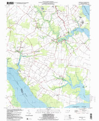
1997 Map of Weeksville
USGS Topo · Published 2000About this map
The USCG Airbase anchors the northern reaches of this coastal landscape where the Pasquotank River meets the Albemarle Sound. This late-twentieth-century survey documents a region defined by intricate tidal creeks and established rural communities. The settlement of Weeksville serves as a central hub, surrounded by numerous houses of worship that testify to the area's social fabric, including the Symonds Creek Tabernacle, Eureka Ch, and Rebecca Ch.
Find a feature on this map
35 named features on this map. Tap any name to fly to it.
Don’t see what you’re looking for? This feature index may not catch every label — zoom into the map to look around manually.
Map Details
Editions of this 1997 Weeksville Map
This is the sole edition of this map. No revisions or reprints were ever made.
Other maps of this area

1906 · Hertford
USGS Topo · 1:62,500

1940 · Hertford
USGS Topo · 1:62,500

1940 · Wade Point
USGS Topo · 1:62,500

1940 · South Mills
USGS Topo · 1:62,500

1943 · Wade Point
USGS Topo · 1:62,500

1948 · Wade Point
USGS Topo · 1:62,500

1948 · Elizabeth City
USGS Topo · 1:62,500

1952 · South Mills
USGS Topo · 1:62,500

1953 · Norfolk
USGS Topo · 1:250,000

1982 · Nixonton
USGS Topo · 1:24,000