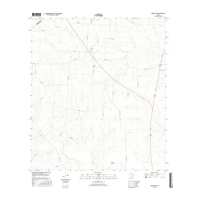
2016 Map of Weesatche
USGS Topo · Published 2016About this map
Woodlawn Cem and Barnes Cem mark the historic settlement landscape along the boundary of DeWitt and Goliad counties. This South Texas region is defined by an intricate network of waterways, including Eighteenmile Cr, Hog Cr, and Manahuilla Cr, which converge as they flow toward the coastal plains. The land use here remains deeply rooted in rural homesteads and agricultural tracts, connected by a dense web of local farm-to-market routes and family-named roads such as Afflerbach Rd and Dohmann Rd.
Find a feature on this map
40 named features on this map. Tap any name to fly to it.
Don’t see what you’re looking for? This feature index may not catch every label — zoom into the map to look around manually.
Map Details
Editions of this 2016 Weesatche Map
This is the sole edition of this map. No revisions or reprints were ever made.
Other maps of this area

1953 · Beeville
USGS Topo · 1:250,000

1956 · Beeville
USGS Topo · 1:250,000

1960 · Beeville
USGS Topo · 1:250,000

1962 · Hensley Lake
USGS Topo · 1:24,000

1962 · Goliad
USGS Topo · 1:24,000

1963 · Meyersville
USGS Topo · 1:24,000

1963 · Weesatche
USGS Topo · 1:24,000
1963 · Yorktown West
USGS Topo · 1:24,000
1963 · Runge SE
USGS Topo · 1:24,000
1963 · Yorktown East
USGS Topo · 1:24,000