1939 Map of Weiner
USGS Topo · Published 1954About this map
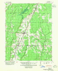
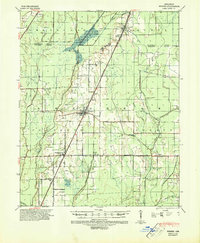
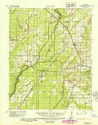
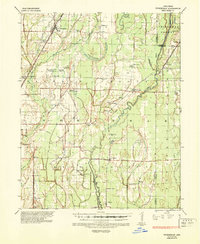
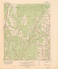
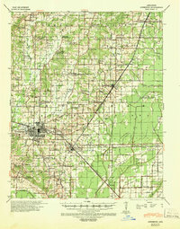
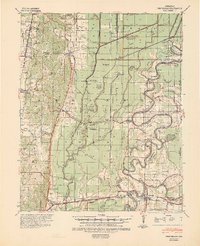
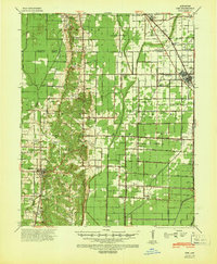
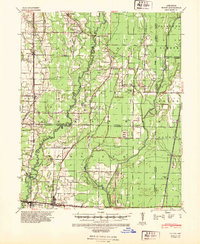
Weiner and Waldenburg serve as the primary hubs in this Poinsett County landscape, which by the late 1930s was defined by an extensive engineering network designed to manage the Arkansas lowlands. The St Louis Southwestern railroad cuts diagonally across the terrain, linking small stops like O Bear Siding and Brainard to the larger regional economy. The map reveals a transition from natural watercourses like De View Bayou and the L'Anguille River to a highly organized system of drainage, including Main Ditch, Johnson Ditch, and Collecting Ditch. This hybrid landscape of bayous and man-made laterals supported a scattering of local institutions, evidenced by the numerous country schools such as Beautiful Home Sch, Ukana Sch, and Hickory Grove Sch that anchored these rural farming communities.
Find a feature on this map
39 named features on this map. Tap any name to fly to it.
Don’t see what you’re looking for? This feature index may not catch every label — zoom into the map to look around manually.
Map Details
Editions of this 1939 Weiner Map
3 editions found
Other maps of this area
1935 · Sedgwick
USGS Topo · 1:62,500

1935 · Alicia
USGS Topo · 1:62,500
1935 · Tuckerman
USGS Topo · 1:62,500
1939 · Vanndale
USGS Topo · 1:62,500

1939 · Weiner
USGS Topo · 1:62,500
1939 · Jonesboro
USGS Topo · 1:62,500
1940 · Princedale
USGS Topo · 1:62,500
1940 · Dee
USGS Topo · 1:62,500
1940 · Tilton
USGS Topo · 1:62,500

1953 · Memphis
USGS Topo · 1:250,000