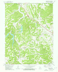
1980 Map of Weingarten
USGS Topo · Published 1980About this map
Weingarten and the surrounding hills of Ste. Genevieve county showcase a landscape defined by deep-set hollows and a storied mineral history. In this 1980 survey, the Missouri Pacific railroad cuts a clear path across the terrain, passing north of the Catholic community at Our Lady of Help Sch. The map records a cluster of heritage settlements including Offenburg and New Offenburg, which neighbor a network of Copper Mines along Copper Mine Creek.
Find a feature on this map
52 named features on this map. Tap any name to fly to it.
Don’t see what you’re looking for? This feature index may not catch every label — zoom into the map to look around manually.
Map Details
Editions of this 1980 Weingarten Map
This is the sole edition of this map. No revisions or reprints were ever made.
Other maps of this area

1904 · Farmington
USGS Topo · 1:62,500

1906 · Farmington
USGS Topo · 1:62,500

1907 · Weingarten
USGS Topo · 1:62,500

1909 · Weingarten
USGS Topo · 1:62,500

1915 · Renault
USGS Topo · 1:62,500

1915 · Crystal City
USGS Topo · 1:62,500

1940 · Renault
USGS Topo · 1:62,500

1949 · Saint Louis
USGS Topo · 1:250,000

1949 · Rolla
USGS Topo · 1:250,000

1949 · Crystal City
USGS Topo · 1:62,500