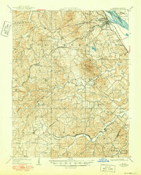
1909 Map of Weingarten
USGS Topo · Published 1950About this map
The riverfront settlement of Ste Genevieve serves as the focal point for this survey, situated along the Mississippi River near Moro Island. The landscape is defined by the winding paths of River aux Vases and Saline Creek, which drain the Beckett Hills. Early industrial activity is evidenced by the presence of the Copper Mine and several important transportation routes, including the Plank Road and the Ste Genevieve Ferry Road.
Find a feature on this map
57 named features on this map. Tap any name to fly to it.
Don’t see what you’re looking for? This feature index may not catch every label — zoom into the map to look around manually.
Map Details
Editions of this 1909 Weingarten Map
3 editions found
Other maps of this area

1904 · Farmington
USGS Topo · 1:62,500

1906 · Farmington
USGS Topo · 1:62,500

1907 · Weingarten
USGS Topo · 1:62,500

1909 · Weingarten
USGS Topo · 1:62,500

1910 · Higdon
USGS Topo · 1:62,500

1912 · Baldwin
USGS Topo · 1:62,500

1914 · Baldwin
USGS Topo · 1:62,500

1915 · Renault
USGS Topo · 1:62,500

1915 · Chester
USGS Topo · 1:62,500

1915 · Crystal City
USGS Topo · 1:62,500