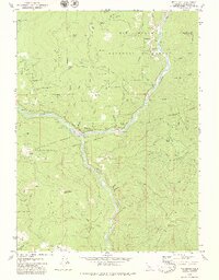
1979 Map of Weitchpec
USGS Topo · Published 1979About this map
Weitchpec serves as the focal point of this 1979 survey, situated at the confluence of the Klamath River and the Trinity River. This junction was a vital nexus for local transportation and settlement within the Hoopa Valley Indian Reservation. The map details a landscape defined by traditional land uses and resource management, showing several high-elevation openings like Fern Prairie, Lake Prairie, and Grasshopper Prairie interspersed among the timber of the Six Rivers National Forest.
Find a feature on this map
75 named features on this map. Tap any name to fly to it.
Don’t see what you’re looking for? This feature index may not catch every label — zoom into the map to look around manually.
Map Details
Editions of this 1979 Weitchpec Map
2 editions found
Other maps of this area

1925 · Hoopa
USGS Topo · 1:125,000

1945 · Coyote Peak
USGS Topo · 1:62,500

1945 · Tectah Creek
USGS Topo · 1:62,500

1948 · Weed
USGS Topo · 1:250,000

1950 · Weed
USGS Topo · 1:250,000

1952 · Coyote Peak
USGS Topo · 1:62,500

1952 · Hoopa
USGS Topo · 1:62,500

1952 · Orleans
USGS Topo · 1:62,500

1952 · Tectah Creek
USGS Topo · 1:62,500

1958 · Weed
USGS Topo · 1:250,000