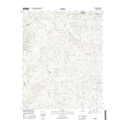
2016 Map of Welcome
USGS Topo · Published 2016About this map
Winston-Salem anchors the northern reaches of this study, where the urban expansion of Forsyth County meets the rural drainages of the Yadkin River valley. The landscape is defined by a dense network of creek systems including Muddy Creek, Miller Cr, and Reedy Creek, which have historically shaped the settlement patterns of Davidson County. Small communities such as Arcadia, Enterprise, and Welcome are connected by a web of established roads like Friedberg Church Rd and Old Salisbury Rd. Local history is preserved at sites like Good Hope Cem and Beulah Cem, which stand as landmarks amidst the residential growth and agricultural tracts that characterize this portion of the Piedmont. The map captures the meeting of three counties—Forsyth, Davidson, and Davie—highlighting the area's role as a suburban and rural crossroads south of the city.
Find a feature on this map
170 named features on this map. Tap any name to fly to it.
Don’t see what you’re looking for? This feature index may not catch every label — zoom into the map to look around manually.
Map Details
Editions of this 2016 Welcome Map
This is the sole edition of this map. No revisions or reprints were ever made.
Other maps of this area

1949 · Eller
USGS Topo · 1:24,000

1950 · Winston-Salem West
USGS Topo · 1:24,000

1950 · Lexington East
USGS Topo · 1:24,000

1950 · Winston-Salem East
USGS Topo · 1:24,000

1950 · Lexington West
USGS Topo · 1:24,000

1950 · Churchland
USGS Topo · 1:24,000

1951 · Winston-Salem West
USGS Topo · 1:24,000

1951 · Winston-Salem East
USGS Topo · 1:24,000

1951 · Churchland
USGS Topo · 1:24,000

1951 · Lexington East
USGS Topo · 1:24,000