Loading...
Loading map...2022 Map of Welcome
USGS Topo · Published 2022About this map
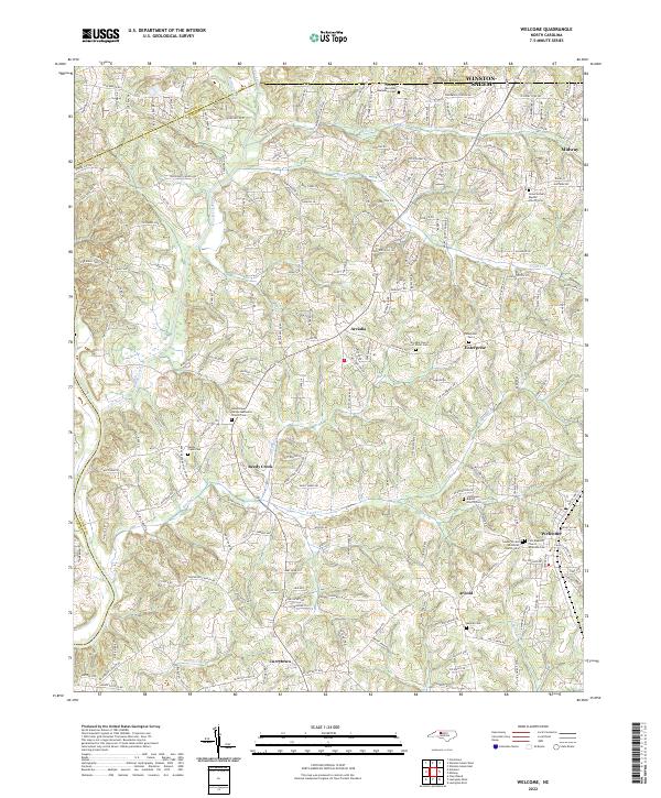
The Yadkin River defines the western edge of this landscape, where the rolling hills of Davidson County meet the southern fringes of Winston-Salem. The settlement pattern centers on long-established communities like Welcome, Arcadia, and Reedy Creek, linked by a dense network of family-named roads. A notable concentration of religious and genealogical sites characterizes the area, including the Friedberg Moravian God's Acre Cem and the Union Grove Baptist Church Cem.
Find a feature on this map
194 named features on this map. Tap any name to fly to it.
Don’t see what you’re looking for? This feature index may not catch every label — zoom into the map to look around manually.
Map Details
Date Portrayed2022
Date Published2022
PublisherU.S. Geological Survey
Map TypeTopographic
Scale1:24000
Physical Dimensions24 x 29 inches
Editions of this 2022 Welcome Map
This is the sole edition of this map. No revisions or reprints were ever made.
Historical Maps of Eureka Mills Through Time
Featured Locations
Source Details
SourceU.S. Geological Survey
CopyrightPublic Domain