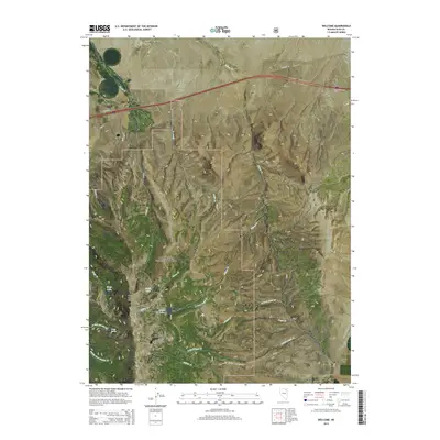
2015 Map of Welcome
USGS Topo · Published 2015About this map
Welcome sits at the northern edge of this high-altitude landscape, where the flat valley floors meet the dramatic rising slopes of the East Humboldt Range. This 2015 study documents a region of transition between the ranching lands of Starr Valley and the protected wilderness of the Humboldt National Forest. The map detail highlights a rugged alpine hydrology, centered on a series of glacial basins including Angel Lake, Smith Lake, and Greys Lake. These high-country waters feed a network of drainages such as N Fork Angel Cr and Willow Cr that flow toward the lower basins. Prominent landmarks like Chimney Rock and Greys Peak anchor the ridgeline, which serves as a natural barrier between the agricultural corridors of the west and the more remote reaches of Clover Valley to the southeast. The infrastructure of the era is represented by Highway 40 and various forest development roads including Natl Forest Develop Road 502 Rd.
Find a feature on this map
34 named features on this map. Tap any name to fly to it.
Don’t see what you’re looking for? This feature index may not catch every label — zoom into the map to look around manually.
Map Details
Editions of this 2015 Welcome Map
This is the sole edition of this map. No revisions or reprints were ever made.
Other maps of this area

1935 · Halleck
USGS Topo · 1:125,000

1955 · Wells
USGS Topo · 1:250,000

1955 · Elko
USGS Topo · 1:250,000

1958 · Wells
USGS Topo · 1:250,000

1958 · Elko
USGS Topo · 1:250,000

1961 · Wells
USGS Topo · 1:250,000

1962 · Elko
USGS Topo · 1:250,000

1965 · Elko
USGS Topo · 1:250,000

1967 · Welcome
USGS Topo · 1:24,000

1967 · Herder Creek
USGS Topo · 1:24,000