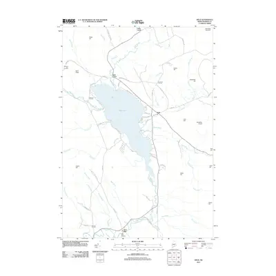
2011 Map of Weld
USGS Topo · Published 2011About this map
Webb Lake dominates the central landscape of this 2011 survey, serving as the geographic heart of the Weld community. The settlement pattern follows the lake's eastern shore and the narrow valley of the Webb River as it flows south toward Berry Mills. Local history is preserved in a series of family-named landmarks and burial grounds, including the Mountain View Cemetery on Rand Ridge and the Newman Cemetery near the confluence of Dunning Brook.
Find a feature on this map
68 named features on this map. Tap any name to fly to it.
Don’t see what you’re looking for? This feature index may not catch every label — zoom into the map to look around manually.
Map Details
Editions of this 2011 Weld Map
This is the sole edition of this map. No revisions or reprints were ever made.
Other maps of this area

1926 · Dixfield
USGS Topo · 1:62,500

1927 · Rumford
USGS Topo · 1:48,000

1929 · Phillips
USGS Topo · 1:48,000

1929 · Dixfield
USGS Topo · 1:62,500

1930 · Rumford
USGS Topo · 1:62,500

1932 · Phillips
USGS Topo · 1:62,500

1933 · Rangeley
USGS Topo · 1:48,000

1939 · Rangeley
USGS Topo · 1:62,500

1949 · Rangeley
USGS Topo · 1:62,500

1950 · Lewiston
USGS Topo · 1:250,000