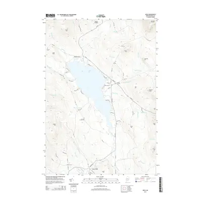
2014 Map of Weld
USGS Topo · Published 2014About this map
Webb Lake dominates this portion of Franklin County, where the valley floor is surrounded by a ring of prominent peaks. To the north, the settlement of Weld and the junction at Weld Corner serve as local anchors, while Berry Mills sits further south along the Webb River. This 2014 survey reveals a landscape defined by its narrow roads and family burial grounds, including the Old Tainter Burying Ground and Newman Cem. The terrain rises sharply from the lakefront toward landmarks like Hurricane Mountain, Center Hill, and the distinctive Houghton Ledges. Numerous small waterways such as Parlin Brook and Swett Brook drain the highlands into the central basin, illustrating the hydrology that has shaped local settlement patterns for generations.
Find a feature on this map
83 named features on this map. Tap any name to fly to it.
Don’t see what you’re looking for? This feature index may not catch every label — zoom into the map to look around manually.
Map Details
Editions of this 2014 Weld Map
This is the sole edition of this map. No revisions or reprints were ever made.
Other maps of this area

1926 · Dixfield
USGS Topo · 1:62,500

1927 · Rumford
USGS Topo · 1:48,000

1929 · Phillips
USGS Topo · 1:48,000

1929 · Dixfield
USGS Topo · 1:62,500

1930 · Rumford
USGS Topo · 1:62,500

1932 · Phillips
USGS Topo · 1:62,500

1933 · Rangeley
USGS Topo · 1:48,000

1939 · Rangeley
USGS Topo · 1:62,500

1949 · Rangeley
USGS Topo · 1:62,500

1950 · Lewiston
USGS Topo · 1:250,000