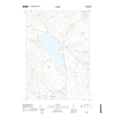
2018 Map of Weld
USGS Topo · Published 2018About this map
Webb Lake serves as the central focal point of this Franklin County landscape, where the settlements of Weld and Berry Mills anchor the regional geography. The shoreline is punctuated by numerous named access points including Dummers Ln and Webb Beach Rd, while the surrounding terrain rises sharply toward peaks like Hurricane Mtn and Hedgehog Hill. This area, situated within the towns of Carthage and Weld, retains a significant genealogical footprint through its many small family and community graveyards. Researchers can locate the Old Tainter Burial Ground near the western shore, as well as the Robertson Cem and Mountain View Cem. The hydrology is defined by a dense network of mountain streams, such as Houghton Brook and Bachelor Brook, which feed the Webb River as it flows south toward the Oxford County border.
Find a feature on this map
71 named features on this map. Tap any name to fly to it.
Don’t see what you’re looking for? This feature index may not catch every label — zoom into the map to look around manually.
Map Details
Editions of this 2018 Weld Map
This is the sole edition of this map. No revisions or reprints were ever made.
Other maps of this area

1926 · Dixfield
USGS Topo · 1:62,500

1927 · Rumford
USGS Topo · 1:48,000

1929 · Phillips
USGS Topo · 1:48,000

1929 · Dixfield
USGS Topo · 1:62,500

1930 · Rumford
USGS Topo · 1:62,500

1932 · Phillips
USGS Topo · 1:62,500

1933 · Rangeley
USGS Topo · 1:48,000

1939 · Rangeley
USGS Topo · 1:62,500

1949 · Rangeley
USGS Topo · 1:62,500

1950 · Lewiston
USGS Topo · 1:250,000