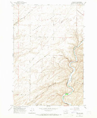
1966 Map of Welland
USGS Topo · Published 1968About this map
Eureka Flat dominates the northern reaches of this mid-1960s survey, a landscape defined by industrial agriculture and the strategic path of the Northern Pacific railroad. The settlement of Welland serves as a focal point for the regional rail network, surrounded by a grid of named rural thoroughfares such as Britton Road and Kellogg Road. To the south, the terrain shifts dramatically into the winding valley of the Touchet River, where the geography transitions from plateau to canyon. The agricultural economy is clearly etched into the land through features like multiple Grain Elevators and Storage Bins positioned along the river and rail lines. These structures, alongside the presence of Ninemile Canyon, illustrate the intersection of the region’s topography with the logistical needs of 20th-century grain transport.
Find a feature on this map
24 named features on this map. Tap any name to fly to it.
Don’t see what you’re looking for? This feature index may not catch every label — zoom into the map to look around manually.
Map Details
Editions of this 1966 Welland Map
This is the sole edition of this map. No revisions or reprints were ever made.
Other maps of this area

1915 · Wallulah
USGS Topo · 1:96,000

1918 · Wallula
USGS Topo · 1:125,000

1953 · Walla Walla
USGS Topo · 1:250,000

1958 · Walla Walla
USGS Topo · 1:250,000

1964 · Zangar Junction
USGS Topo · 1:24,000

1964 · Levey SE
USGS Topo · 1:24,000

1964 · Slater
USGS Topo · 1:24,000

1966 · Page
USGS Topo · 1:24,000
1966 · Touchet
USGS Topo · 1:24,000

1966 · Rulo
USGS Topo · 1:24,000