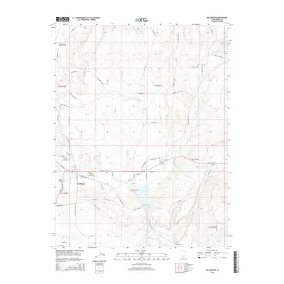
2014 Map of Wellington
USGS Topo · Published 2014About this map
Wellington serves as the central hub of this Carbon County landscape, situated where the Price River meets a complex network of agricultural and industrial infrastructure. The settlement is defined by its grid of residential streets like E Main St and E Railroad Ave, as well as the nearby Wellington City Cem. The surrounding terrain transitions from the irrigated lowlands of the Wellington Canal to a series of prominent elevated landforms, including McNulty Bench, Gravel Pit Bench, and Milts Bench. Industrial history is evident in features such as the U S Steel Corp Storage Reservoir and the Washer Plant Rd, while the Carbon County Regional Airport marks the northwestern corner of the quadrangle. Drainages like Coal Cr and Soldier Cr cut through the benchlands, leading toward the distinct topography of Cat Canyon to the east.
Find a feature on this map
57 named features on this map. Tap any name to fly to it.
Don’t see what you’re looking for? This feature index may not catch every label — zoom into the map to look around manually.
Map Details
Editions of this 2014 Wellington Map
This is the sole edition of this map. No revisions or reprints were ever made.
Other maps of this area

1886 · Price River
USGS Topo · 1:250,000

1896 · Price River
USGS Topo · 1:250,000

1914 · Castle Gate
USGS Topo · 1:62,500

1915 · Wellington
USGS Topo · 1:62,500

1916 · Castle Gate
USGS Topo · 1:62,500

1956 · Price
USGS Topo · 1:250,000

1960 · Price
USGS Topo · 1:250,000

1962 · Price
USGS Topo · 1:250,000

1969 · Olsen Reservoir
USGS Topo · 1:24,000

1969 · Elmo
USGS Topo · 1:24,000