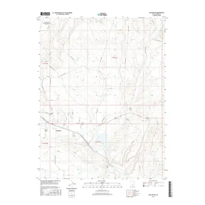
2017 Map of Wellington
USGS Topo · Published 2017About this map
Wellington serves as the focal point of this Carbon County landscape, situated at the confluence of transport and irrigation corridors that defined the region's development. The Price River winds through the lower half of the area, shadowed by W Railroad Ave and the Washer/Ricant Rd, indicating the intersection of water resources and industrial transit. To the north, the terrain transitions into broad plateaus like Jack Rabbit Flats and Gravel Pit Bench, while the Wellington Canal and Canal Rd highlight the vital role of water management in the high desert. Local genealogy is anchored at the Wellington City Cem, while the northern edge of the map features the Carbon County Regional Airport/Buck Davis Field. The landscape is etched with numerous drainages, including Coal Cr and Soldier Cr, which carve through the distinct benches and canyons like Cat Canyon.
Find a feature on this map
49 named features on this map. Tap any name to fly to it.
Don’t see what you’re looking for? This feature index may not catch every label — zoom into the map to look around manually.
Map Details
Editions of this 2017 Wellington Map
This is the sole edition of this map. No revisions or reprints were ever made.
Other maps of this area

1886 · Price River
USGS Topo · 1:250,000

1896 · Price River
USGS Topo · 1:250,000

1914 · Castle Gate
USGS Topo · 1:62,500

1915 · Wellington
USGS Topo · 1:62,500

1916 · Castle Gate
USGS Topo · 1:62,500

1956 · Price
USGS Topo · 1:250,000

1960 · Price
USGS Topo · 1:250,000

1962 · Price
USGS Topo · 1:250,000

1969 · Olsen Reservoir
USGS Topo · 1:24,000

1969 · Elmo
USGS Topo · 1:24,000