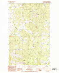
1985 Map of Wellington Peak
USGS Topo · Published 1985About this map
The rugged Huckleberry Range and The Summit Range define this high-elevation corner of Stevens County, where 1980s surveyors documented a landscape shaped by mining and rural persistence. Resource extraction is evident in the numerous sites scattered across the peaks, from the Tempest Mine in the north to the Columbia Tungsten Mine near Wellington Peak. These industrial markers sit alongside signs of early 20th-century settlement, including the Waterloo School and small community points like Magee and Maud. The presence of a Cem and isolated features like a Corral and Storage Bin suggest the area's history as a working landscape of small-scale ranching and mineral prospecting. Steep drainages like Courtright Canyon and Stranger Creek separate the many named summits, including Old Baldy and Buttercup Hill.
Find a feature on this map
42 named features on this map. Tap any name to fly to it.
Don’t see what you’re looking for? This feature index may not catch every label — zoom into the map to look around manually.
Map Details
Editions of this 1985 Wellington Peak Map
2 editions found
Other maps of this area

1927 · Chewelah
USGS Topo · 1:125,000

1930 · Chewelah
USGS Topo · 1:125,000

1948 · Hunters
USGS Topo · 1:62,500

1950 · Hunters
USGS Topo · 1:62,500

1950 · Inchelium
USGS Topo · 1:62,500

1954 · Okanogan
USGS Topo · 1:250,000

1958 · Okanogan
USGS Topo · 1:250,000

1958 · Sandpoint
USGS Topo · 1:250,000

1963 · Sandpoint
USGS Topo · 1:250,000
1965 · Dunn Mountain
USGS Topo · 1:24,000