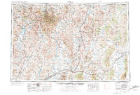
1955 Map of Wells
USGS Topo · Published 1973About this map
The Humboldt River headwaters and the high-desert ranges of northeastern Nevada define this mid-century topographic study. The landscape is a corridor of transit, where the Southern Pacific and Western Pacific railroads trace the valleys, supported by a network of sidings like Fenelon Siding, Holborn Siding, and Valley Pass Siding. Significant ranching and mining hubs are scattered throughout the Independence Mountains and Pequop Mountains, including the high-altitude Charleston and the industrial site at Delano Mines.
Find a feature on this map
122 named features on this map. Tap any name to fly to it.
Don’t see what you’re looking for? This feature index may not catch every label — zoom into the map to look around manually.
Map Details
Editions of this 1955 Wells Map
4 editions found

Other maps of this area

1935 · Halleck
USGS Topo · 1:125,000

1935 · Charleston
USGS Topo · 1:48,000

1936 · Mountain City
USGS Topo · 1:62,500

1936 · Rowland
USGS Topo · 1:48,000

1939 · Owyhee
USGS Topo · 1:62,500

1940 · Rowland
USGS Topo · 1:62,500

1940 · Mountain City
USGS Topo · 1:62,500

1942 · Owyhee
USGS Topo · 1:62,500

1942 · Mt. Velma
USGS Topo · 1:62,500

1943 · Jarbidge
USGS Topo · 1:62,500