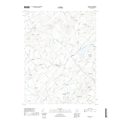
2019 Map of Wellsville
USGS Topo · Published 2019About this map
Wellsville serves as a central hub in this modern survey of York County, situated where Carlisle Rd and Main St intersect. The landscape is defined by the winding course of Conewago Creek and the expansive Gifford Pinchot State Park, which encompasses Pinchot Lake. This map reveals a community structured around historically significant corridors like Old York Rd, connecting smaller settlements such as Roseville and Mount Royal. Local heritage is preserved in landmarks like Salem Cem and Myers Cem, while the area's topographical character is marked by distinctive features including Balanced Rock and Old Toboggan Run Rocks. The survey also documents small-scale aviation at Kampel Airport and Shreveport North Airport, alongside the agricultural and residential patterns that characterize the hills between Bermudian Creek and Stony Run.
Find a feature on this map
143 named features on this map. Tap any name to fly to it.
Don’t see what you’re looking for? This feature index may not catch every label — zoom into the map to look around manually.
Map Details
Editions of this 2019 Wellsville Map
This is the sole edition of this map. No revisions or reprints were ever made.
Other maps of this area

1904 · Carlisle
USGS Topo · 1:62,500

1906 · New Cumberland
USGS Topo · 1:62,500

1908 · Gettysburg
USGS Topo · 1:62,500

1920 · Hanover
USGS Topo · 1:62,500

1922 · Hanover
USGS Topo · 1:62,500

1942 · Gettysburg
USGS Topo · 1:125,000

1943 · New Cumberland
USGS Topo · 1:62,500

1943 · Carlisle
USGS Topo · 1:62,500

1944 · Hampton
USGS Topo · 1:31,680

1948 · Baltimore
USGS Topo · 1:250,000