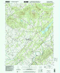
1999 Map of Wellsville
USGS Topo · Published 2002About this map
Wellsville and its surrounding townships in York County reveal a landscape defined by the convergence of several major watercourses, including Conewago Creek and Bermudian Creek. The geography is shaped by prominent peaks such as Flat Mountain, Round Top, and the Dover Mountains, which create a natural boundary for the sprawling State Game Lands No 242. A significant portion of the eastern terrain is occupied by Gifford Pinchot State Park, where Pinchot Lake sits as a central recreational feature.
Find a feature on this map
55 named features on this map. Tap any name to fly to it.
Don’t see what you’re looking for? This feature index may not catch every label — zoom into the map to look around manually.
Map Details
Editions of this 1999 Wellsville Map
This is the sole edition of this map. No revisions or reprints were ever made.
Other maps of this area

1904 · Carlisle
USGS Topo · 1:62,500

1906 · New Cumberland
USGS Topo · 1:62,500

1908 · Gettysburg
USGS Topo · 1:62,500

1920 · Hanover
USGS Topo · 1:62,500

1922 · Hanover
USGS Topo · 1:62,500

1942 · Gettysburg
USGS Topo · 1:125,000

1943 · New Cumberland
USGS Topo · 1:62,500

1943 · Carlisle
USGS Topo · 1:62,500

1944 · Hampton
USGS Topo · 1:31,680

1948 · Baltimore
USGS Topo · 1:250,000