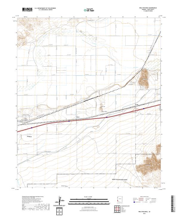
2021 Map of Wellton Mesa
USGS Topo · Published 2021About this map
The Gila River winds through the northern portion of this Yuma County landscape, defining a corridor of agricultural development contrasted against the arid elevations of Antelope Hill and Radar Hill. In the southern reaches, the Baker Peaks rise sharply above the Mohawk Valley, where the ephemeral Coyote Wash cuts through the desert floor. The settlement pattern follows the established transportation routes, with Wellton, Asher, and Noah situated along the primary east-west corridor south of the Wellton Mesa.
Find a feature on this map
52 named features on this map. Tap any name to fly to it.
Don’t see what you’re looking for? This feature index may not catch every label — zoom into the map to look around manually.
Map Details
Editions of this 2021 Wellton Mesa Map
This is the sole edition of this map. No revisions or reprints were ever made.
Other maps of this area

1926 · Wellton
USGS Topo · 1:62,500

1926 · Mohawk
USGS Topo · 1:62,500

1928 · Mohawk
USGS Topo · 1:62,500

1928 · Norton
USGS Topo · 1:62,500

1929 · Wellton
USGS Topo · 1:62,500

1929 · Norton
USGS Topo · 1:62,500

1942 · Yuma
USGS Topo · 1:250,000

1953 · Ajo
USGS Topo · 1:250,000

1954 · El Centro
USGS Topo · 1:250,000

1955 · El Centro
USGS Topo · 1:250,000