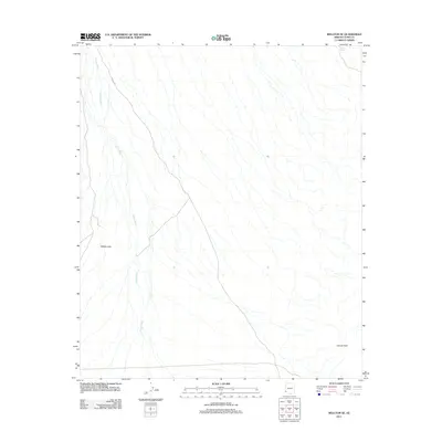
2011 Map of Wellton SE
USGS Topo · Published 2011About this map
Wellton Hills defines the western landscape of this southwestern Arizona region, where the terrain is dominated by complex drainage systems. The most prominent of these is Coyote Wash, which branches extensively across the valley floor, illustrating the ephemeral water patterns characteristic of the Yuma County desert. This 2011 survey documents a largely undeveloped landscape, though it identifies critical water sources like Baker Tanks in the northeastern corner, which have historically served as vital points for travelers and local wildlife. On the eastern edge, Coyote Peak rises as a distinct landmark overlooking the desert flats. Human infrastructure is minimal on this sheet, primarily limited to local transit corridors such as Avenue 30E, providing a clear look at the area's natural state before further modernization.
Find a feature on this map
5 named features on this map. Tap any name to fly to it.
Don’t see what you’re looking for? This feature index may not catch every label — zoom into the map to look around manually.
Map Details
Editions of this 2011 Wellton SE Map
This is the sole edition of this map. No revisions or reprints were ever made.
Other maps of this area

1926 · Wellton
USGS Topo · 1:62,500

1926 · Mohawk
USGS Topo · 1:62,500

1928 · Mohawk
USGS Topo · 1:62,500

1929 · Wellton
USGS Topo · 1:62,500

1942 · Yuma
USGS Topo · 1:250,000

1953 · Ajo
USGS Topo · 1:250,000

1954 · El Centro
USGS Topo · 1:250,000

1955 · El Centro
USGS Topo · 1:250,000

1957 · Ajo
USGS Topo · 1:250,000

1958 · Ajo
USGS Topo · 1:250,000