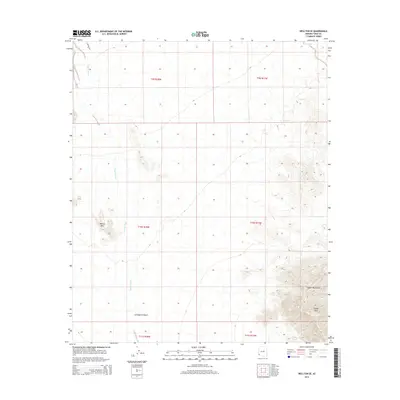
2014 Map of Wellton SE
USGS Topo · Published 2014About this map
The Copper Mountains dominate the southeastern landscape of this Yuma County region, rising sharply above the arid expanse of the Lechuguilla Desert. This arid environment is characterized by significant topographic relief, including the prominent summit of Coyote Peak and the scattered heights of the Wellton Hills. The drainage patterns of the Coyote Wash cut through the desert floor, providing a glimpse into the hydraulic systems that define this part of the Sonoran landscape. Human infrastructure is notably sparse, represented primarily by S Avenue 30 E and the isolated Baker Tanks in the northeast. The map provides a precise look at the township and range boundaries, illustrating how the Public Land Survey System partitions this open desert terrain into sections during the early 21st century.
Find a feature on this map
13 named features on this map. Tap any name to fly to it.
Don’t see what you’re looking for? This feature index may not catch every label — zoom into the map to look around manually.
Map Details
Editions of this 2014 Wellton SE Map
This is the sole edition of this map. No revisions or reprints were ever made.
Other maps of this area

1926 · Wellton
USGS Topo · 1:62,500

1926 · Mohawk
USGS Topo · 1:62,500

1928 · Mohawk
USGS Topo · 1:62,500

1929 · Wellton
USGS Topo · 1:62,500

1942 · Yuma
USGS Topo · 1:250,000

1953 · Ajo
USGS Topo · 1:250,000

1954 · El Centro
USGS Topo · 1:250,000

1955 · El Centro
USGS Topo · 1:250,000

1957 · Ajo
USGS Topo · 1:250,000

1958 · Ajo
USGS Topo · 1:250,000