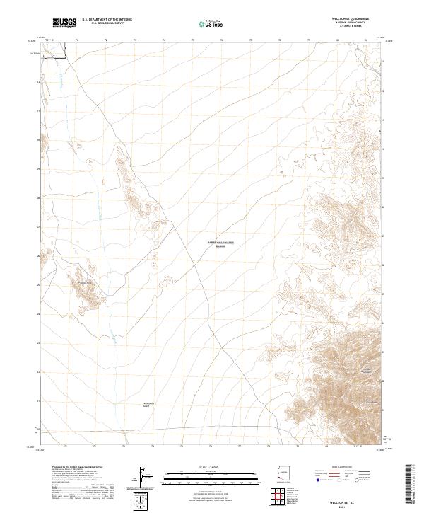
2021 Map of Wellton SE
USGS Topo · Published 2021About this map
The Lechuguilla Desert spreads across this arid landscape, a region defined by stark topographic contrasts and intermittent drainage patterns. In the eastern portion of the sheet, the Copper Mountains rise sharply, culminating at Coyote Peak, while the lower Wellton Hills dominate the central-western section. This desert environment is sculpted by the persistent path of Coyote Wash, which meanders through the sandy basins. The lack of permanent structures or developed settlements highlights the remote character of this corner of Yuma County, where the landscape remains largely an open expanse of desert floor and craggy summits. The map serves as a precise record of the natural landforms and township boundaries that structure this portion of the Southwestern borderlands.
Find a feature on this map
11 named features on this map. Tap any name to fly to it.
Don’t see what you’re looking for? This feature index may not catch every label — zoom into the map to look around manually.
Map Details
Editions of this 2021 Wellton SE Map
This is the sole edition of this map. No revisions or reprints were ever made.
Other maps of this area

1926 · Wellton
USGS Topo · 1:62,500

1926 · Mohawk
USGS Topo · 1:62,500

1928 · Mohawk
USGS Topo · 1:62,500

1929 · Wellton
USGS Topo · 1:62,500

1942 · Yuma
USGS Topo · 1:250,000

1953 · Ajo
USGS Topo · 1:250,000

1954 · El Centro
USGS Topo · 1:250,000

1955 · El Centro
USGS Topo · 1:250,000

1957 · Ajo
USGS Topo · 1:250,000

1958 · Ajo
USGS Topo · 1:250,000