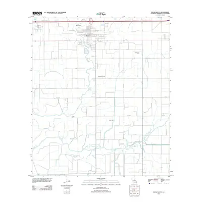
2012 Map of Welsh South
USGS Topo · Published 2012About this map
Welsh sits at the northern edge of this Jefferson Davis Parish landscape, where the prairie begins to transition into the intricate drainage systems of the Louisiana coast. The town's infrastructure is closely tied to both the agricultural and energy sectors, evidenced by the proximity of the Welsh Oil and Gas Field and the North Niblett Gas Field. Transport and aviation are central to this region's layout, with several facilities including the Welsh Airport, Ag Aviation Airport, and Aerolite Aero Park serving the local farming and industrial needs.
Find a feature on this map
75 named features on this map. Tap any name to fly to it.
Don’t see what you’re looking for? This feature index may not catch every label — zoom into the map to look around manually.
Map Details
Editions of this 2012 Welsh South Map
This is the sole edition of this map. No revisions or reprints were ever made.
Other maps of this area

1946 · Lacassine
USGS Topo · 1:31,680

1946 · Lake Arthur
USGS Topo · 1:31,680

1946 · Hayes
USGS Topo · 1:31,680

1946 · Jennings
USGS Topo · 1:31,680

1947 · Fenton
USGS Topo · 1:31,680

1947 · Thornwell
USGS Topo · 1:31,680

1947 · Pine Island
USGS Topo · 1:31,680

1947 · Welsh
USGS Topo · 1:31,680

1947 · Hathaway
USGS Topo · 1:31,680
1949 · Hayes
USGS Topo · 1:31,680