
2024 Map of Welsh South
USGS Topo · Published 2024About this map
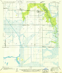
Welsh serves as the primary hub in this southern Jefferson Davis Parish landscape, where the town grid is defined by the proximity of NW Railroad Ave and a network of parish roads. The area's agricultural identity is reinforced by the presence of the Welsh Airport and AG Aviation Airport, suggesting a reliance on aerial crop management for the surrounding fields. The natural drainage of the East Bayou Lacassine and Bayou Chene is augmented by the engineered Welsh Canal, reflecting a long history of water management in the Louisiana prairie.
Find a feature on this map
87 named features on this map. Tap any name to fly to it.
Don’t see what you’re looking for? This feature index may not catch every label — zoom into the map to look around manually.
Map Details
Editions of this 2024 Welsh South Map
This is the sole edition of this map. No revisions or reprints were ever made.
Other maps of this area

1946 · Lacassine
USGS Topo · 1:31,680

1946 · Lake Arthur
USGS Topo · 1:31,680

1946 · Hayes
USGS Topo · 1:31,680

1946 · Jennings
USGS Topo · 1:31,680

1947 · Fenton
USGS Topo · 1:31,680

1947 · Thornwell
USGS Topo · 1:31,680

1947 · Pine Island
USGS Topo · 1:31,680

1947 · Welsh
USGS Topo · 1:31,680

1947 · Hathaway
USGS Topo · 1:31,680
1949 · Hayes
USGS Topo · 1:31,680