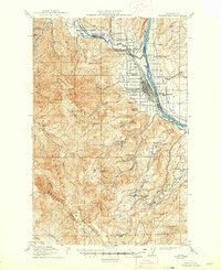
1915 Map of Wenatchee
USGS Topo · Published 1948About this map
Wenatchee and its surrounding orchards occupy the fertile terrace where the Wenatchee River meets the Columbia River in this survey based on fieldwork from 1911–1913. The landscape is defined by the early development of irrigation, with numerous Ditch lines cutting across the hillsides to support the region's agricultural growth. The Great Northern Railway hugs the riverbanks, connecting the town to broader markets, while the Old Ellensburg Trail winds through the southern high country of the Wenatchee Mountains. Rural education is a cornerstone of the mapped community, evidenced by the dense network of numbered and named campuses like Ferry School, Beacon Hill School, and Pitcher School. To the west, the boundaries of the Wenatchee National Forest rise toward peaks like Beehive Mtn and Old Baldy, marking the transition from valley floor to protected wilderness.
Find a feature on this map
52 named features on this map. Tap any name to fly to it.
Don’t see what you’re looking for? This feature index may not catch every label — zoom into the map to look around manually.
Map Details
Editions of this 1915 Wenatchee Map
3 editions found
Other maps of this area

1897 · Mount Stuart
USGS Topo · 1:125,000

1901 · Chelan
USGS Topo · 1:125,000

1901 · Chiwaukum
USGS Topo · 1:125,000

1902 · Mount Stuart
USGS Topo · 1:125,000

1904 · Chiwaukum
USGS Topo · 1:125,000

1912 · Malaga
USGS Topo · 1:48,000

1913 · Wenatchee
USGS Topo · 1:62,500

1914 · Malaga
USGS Topo · 1:62,500

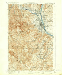
1915 · Wenatchee
USGS Topo · 1:62,500

1920 · Colockum Pass
USGS Topo · 1:125,000