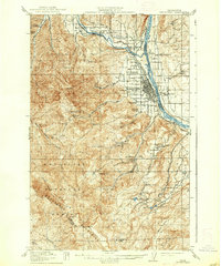
1915 Map of Wenatchee
USGS Topo · Published 1937About this map
The confluence of the Columbia River and the Wenatchee River anchors this 1915 survey, illustrating a landscape transitioning into a major agricultural hub. The city of Wenatchee is clearly established along the Great Northern railroad tracks, while the surrounding hills and plateaus, such as Wenatchee Heights, are already dotted with schools like School No 60 and School No 66. This mapping era precedes the massive hydroelectric projects of the mid-20th century, showing the river systems and irrigation features like the Wheeler Reservoir in their early configurations.
Find a feature on this map
49 named features on this map. Tap any name to fly to it.
Don’t see what you’re looking for? This feature index may not catch every label — zoom into the map to look around manually.
Map Details
Editions of this 1915 Wenatchee Map
3 editions found
Other maps of this area

1897 · Mount Stuart
USGS Topo · 1:125,000

1901 · Chelan
USGS Topo · 1:125,000

1901 · Chiwaukum
USGS Topo · 1:125,000

1902 · Mount Stuart
USGS Topo · 1:125,000

1904 · Chiwaukum
USGS Topo · 1:125,000

1912 · Malaga
USGS Topo · 1:48,000

1913 · Wenatchee
USGS Topo · 1:62,500

1914 · Malaga
USGS Topo · 1:62,500

1915 · Wenatchee
USGS Topo · 1:62,500

1920 · Colockum Pass
USGS Topo · 1:125,000