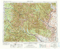
1957 Map of Wenatchee
USGS Topo · Published 1992About this map
The Cascade Range and the Wenatchee Mountains dominate this 1957 survey, illustrating the complex relationship between alpine geography and the infrastructure of the Pacific Northwest. Industrial and municipal footprints are clear, from the Sunset Mine in the north to the vital Everett Water Works Intake and Tacoma Water Works Intake sites. The map documents a critical period for transportation as the Great Northern RR, Northern Pacific RR, and the Chicago Milwaukee St Paul & Pacific RR navigate the mountain passes alongside early highway routes like U.S. 2 and U.S. 10. Settlements like Leavenworth, Snoqualmie, and Wenatchee appear as hubs for the logging and rail industries. The presence of the Glacier Peak Wilderness and numerous state parks like Lake Easton State Park highlights the early preservation of these high-altitude landscapes amidst growing regional development.
Find a feature on this map
137 named features on this map. Tap any name to fly to it.
Don’t see what you’re looking for? This feature index may not catch every label — zoom into the map to look around manually.
Map Details
Editions of this 1957 Wenatchee Map
2 editions found

Other maps of this area

1895 · Snohomish
USGS Topo · 1:125,000

1897 · Mount Stuart
USGS Topo · 1:125,000

1897 · Tacoma
USGS Topo · 1:125,000

1897 · Seattle
USGS Topo · 1:125,000

1899 · Glacier Peak
USGS Topo · 1:125,000

1899 · Stillaguamish
USGS Topo · 1:125,000

1899 · Ellensburg
USGS Topo · 1:125,000

1899 · Methow
USGS Topo · 1:125,000

1900 · Tacoma
USGS Topo · 1:125,000

1901 · Glacier Peak
USGS Topo · 1:125,000