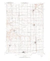
1934 Map of Wenona
USGS Topo · Published 1965About this map
Wenona and Toluca serve as the primary rail hubs for this portion of the Illinois prairie during the mid-1930s. The landscape is defined by an incredibly dense network of rural one-room schools, including uniquely named institutions like Black College Sch, Brushy College Sch, and British Lane Sch. This distribution reflects a highly organized agrarian society where educational centers were placed within walking distance of the numerous family farms that spanned the border of Marshall and La Salle counties.
Find a feature on this map
81 named features on this map. Tap any name to fly to it.
Don’t see what you’re looking for? This feature index may not catch every label — zoom into the map to look around manually.
Map Details
Editions of this 1934 Wenona Map
2 editions found

Other maps of this area

1892 · Ottawa
USGS Topo · 1:62,500

1893 · Lacon
USGS Topo · 1:62,500

1893 · Hennepin
USGS Topo · 1:62,500

1893 · Metamora
USGS Topo · 1:62,500

1893 · Lasalle
USGS Topo · 1:62,500

1909 · Hennepin
USGS Topo · 1:62,500

1911 · La Salle
USGS Topo · 1:62,500

1911 · Hennepin
USGS Topo · 1:62,500

1913 · La Salle
USGS Topo · 1:62,500

1915 · Ottawa
USGS Topo · 1:62,500