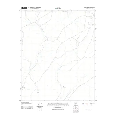
2011 Map of Wepo Village
USGS Topo · Published 2011About this map
Wepo Village serves as the primary settlement hub in this high-desert landscape of Arizona's Navajo County, situated at the edge of the Sand Hills. The environment is defined by its vital water sources, with numerous named springs appearing across the terrain, including Cat Spring, Donkey Spring, and Sheep Spring. These points of interest indicate the historical and contemporary importance of water management in a region where geography is shaped by features like One Cottonwood Canyon. Transportation is anchored by Indian Rte 4, which provides the main artery through the area, connecting the local population centers and their surrounding agricultural or grazing lands. The distribution of Fly Spring, Sand Spring, and Sand Hill Spring alongside the Wepo Spring near the village itself illustrates a landscape where human settlement and natural geography are deeply intertwined around these precious desert resources.
Find a feature on this map
11 named features on this map. Tap any name to fly to it.
Don’t see what you’re looking for? This feature index may not catch every label — zoom into the map to look around manually.
Map Details
Editions of this 2011 Wepo Village Map
This is the sole edition of this map. No revisions or reprints were ever made.
Other maps of this area

1883 · Marsh Pass
USGS Topo · 1:250,000

1883 · Tusayan
USGS Topo · 1:250,000

1886 · Tusayan
USGS Topo · 1:250,000

1892 · Marsh Pass
USGS Topo · 1:250,000

1947 · Flagstaff
USGS Topo · 1:250,000

1954 · Flagstaff
USGS Topo · 1:250,000

1956 · Marble Canyon
USGS Topo · 1:250,000

1958 · Flagstaff
USGS Topo · 1:250,000

1959 · Marble Canyon
USGS Topo · 1:250,000

1960 · Flagstaff
USGS Topo · 1:250,000