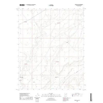
2018 Map of Wepo Village
USGS Topo · Published 2018About this map
Wepo Village and the surrounding Wepo Valley form the focal point of this high-desert landscape in the Navajo Nation during the early twenty-first century. The terrain is defined by a network of drainage systems and seasonal water sources, most notably Wepo Wash and Polacca Wash, which cut through the complex topography of First Mesa. Small, named water sources like Donkey Spring and Fly Spring indicate the critical importance of localized water points in this arid environment. Transportation through the region relies on the established routes of Indian Rte 80 and Indian Rte 60. The map also illustrates natural landmarks such as One Cottonwood Canyon and the Sand Hills, providing a detailed view of the geographic features that shape the settlement patterns and local movement within the Chinle Agency.
Find a feature on this map
20 named features on this map. Tap any name to fly to it.
Don’t see what you’re looking for? This feature index may not catch every label — zoom into the map to look around manually.
Map Details
Editions of this 2018 Wepo Village Map
This is the sole edition of this map. No revisions or reprints were ever made.
Other maps of this area

1883 · Marsh Pass
USGS Topo · 1:250,000

1883 · Tusayan
USGS Topo · 1:250,000

1886 · Tusayan
USGS Topo · 1:250,000

1892 · Marsh Pass
USGS Topo · 1:250,000

1947 · Flagstaff
USGS Topo · 1:250,000

1954 · Flagstaff
USGS Topo · 1:250,000

1956 · Marble Canyon
USGS Topo · 1:250,000

1958 · Flagstaff
USGS Topo · 1:250,000

1959 · Marble Canyon
USGS Topo · 1:250,000

1960 · Flagstaff
USGS Topo · 1:250,000