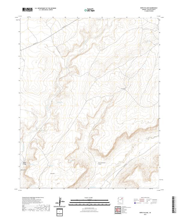
2021 Map of Wepo Village
USGS Topo · Published 2021About this map
Wepo Village sits at the edge of a landscape defined by dramatic shifts in elevation, where the drainage of Wepo Wash cuts through the desert floor. This 2021 survey of the Navajo Nation interior illustrates the spatial relationship between modern roadways like Indian Rte 43 and the ancient landforms of First Mesa. The mapping reveals a concentration of water sources critical to this arid environment, including Wepo Spring, Sand-Spring, and Cat Spring, often located near canyon walls or at the base of prominent rises. To the south, the terrain opens into the Sand Hills and the broader valley of Polacca Wash. This juxtaposition of named springs and complex canyon systems like One Cottonwood Canyon highlights the enduring importance of water and high-ground navigation in Navajo County's topography.
Find a feature on this map
20 named features on this map. Tap any name to fly to it.
Don’t see what you’re looking for? This feature index may not catch every label — zoom into the map to look around manually.
Map Details
Editions of this 2021 Wepo Village Map
This is the sole edition of this map. No revisions or reprints were ever made.
Other maps of this area

1883 · Marsh Pass
USGS Topo · 1:250,000

1883 · Tusayan
USGS Topo · 1:250,000

1886 · Tusayan
USGS Topo · 1:250,000

1892 · Marsh Pass
USGS Topo · 1:250,000

1947 · Flagstaff
USGS Topo · 1:250,000

1954 · Flagstaff
USGS Topo · 1:250,000

1956 · Marble Canyon
USGS Topo · 1:250,000

1958 · Flagstaff
USGS Topo · 1:250,000

1959 · Marble Canyon
USGS Topo · 1:250,000

1960 · Flagstaff
USGS Topo · 1:250,000