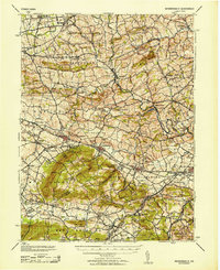
1953 Map of Wernersville
USGS Topo · Published 1953About this map
The rolling landscape of western Berks County at the mid-century reveals a dense network of valley settlements and institutional landmarks. Tulpehocken Creek and Cacoosing Creek define the drainage of this region, supporting early industrial sites like Kricks Mill and providing the corridor for the Reading railroad. Major social landmarks dominate the foothills of South Mountain, including the extensive grounds of the Wernersville State Hospital, the Jesuit College, and the Bethany Orphans Home. These facilities, alongside smaller religious sites like the South Mt Mission and the Blue Meeting House, illustrate a landscape shaped by communal and religious service.
Find a feature on this map
93 named features on this map. Tap any name to fly to it.
Don’t see what you’re looking for? This feature index may not catch every label — zoom into the map to look around manually.
Map Details
Editions of this 1953 Wernersville Map
This is the sole edition of this map. No revisions or reprints were ever made.
Other maps of this area

1889 · Pottsville
USGS Topo · 1:62,500

1891 · Pottsville
USGS Topo · 1:62,500

1891 · Lebanon
USGS Topo · 1:62,500

1892 · Pine Grove
USGS Topo · 1:62,500

1893 · Lebanon
USGS Topo · 1:62,500

1894 · Reading
USGS Topo · 1:62,500

1899 · Lebanon
USGS Topo · 1:62,500

1902 · Wernersville
USGS Topo · 1:62,500

1902 · Lancaster
USGS Topo · 1:62,500

1904 · Lancaster
USGS Topo · 1:62,500