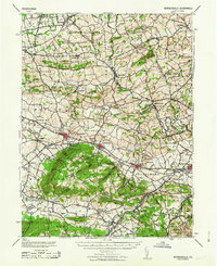
1963 Map of Wernersville
USGS Topo · Published 1963About this map
Eagle Peak and the high ridges of South Mountain dominate this mid-century survey of the Pennsylvania Dutch countryside. The landscape is a network of small boroughs and townships where institutional landmarks like the Bethany Orphans Home and the Jesuit College sit alongside the established routes of the Reading RR. Settlement patterns follow the winding course of the Tulpehocken Creek, which powers sites like Kricks Mill, while local spiritual life is anchored by the Blue Meeting House and the Dunkard Ch. In the valley, the Wernersville State Hospital serves as a major regional landmark near the growing settlements of Wernersville and Sinking Spring. The map captures a moment before modern suburbanization, where rail stops like Womelsdorf Sta still defined the movement of goods and people between Berks County and Lebanon County.
Find a feature on this map
94 named features on this map. Tap any name to fly to it.
Don’t see what you’re looking for? This feature index may not catch every label — zoom into the map to look around manually.
Map Details
Editions of this 1963 Wernersville Map
This is the sole edition of this map. No revisions or reprints were ever made.
Other maps of this area

1889 · Pottsville
USGS Topo · 1:62,500

1891 · Pottsville
USGS Topo · 1:62,500

1891 · Lebanon
USGS Topo · 1:62,500

1892 · Pine Grove
USGS Topo · 1:62,500

1893 · Lebanon
USGS Topo · 1:62,500

1894 · Reading
USGS Topo · 1:62,500

1899 · Lebanon
USGS Topo · 1:62,500

1902 · Wernersville
USGS Topo · 1:62,500

1902 · Lancaster
USGS Topo · 1:62,500

1904 · Lancaster
USGS Topo · 1:62,500