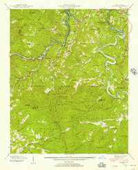
1940 Map of Wesser
USGS Topo · Published 1957About this map
Fontana Lake dominates the northern reaches of this landscape, its newly formed shoreline following the deep mountain cuts of the Little Tennessee River and Tennessee River. The 1940 field examination captures the region as the Tennessee Valley Authority transformed the geography, noting areas soon to be submerged by the rising pool. This shift in the landscape forced the relocation of families from settlements like Almond and Needmore. Along the banks of the Nantahala River, the Southern RR winds through the Nantahala Gorge, supporting local industry evidenced by the Wesser Creek Smelter. Higher elevations are defined by the peaks of the Nantahala Mountains, including the prominent Wesser Bald with its Lookout Tower. Scattered family and community landmarks, such as Watia Ch and the Tabor Cem, mark the cultural footprint of Swain and Macon counties before the full impact of mid-century hydroelectric development.
Find a feature on this map
112 named features on this map. Tap any name to fly to it.
Don’t see what you’re looking for? This feature index may not catch every label — zoom into the map to look around manually.
Map Details
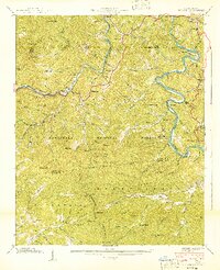
Editions of this 1940 Wesser Map
2 editions found
Other maps of this area

1891 · Cowee
USGS Topo · 1:125,000

1897 · Cowee
USGS Topo · 1:125,000

1907 · Cowee
USGS Topo · 1:125,000

1933 · Bryson
USGS Topo · 1:62,500

1933 · Bushnell
USGS Topo · 1:62,500

1935 · Franklin
USGS Topo · 1:24,000

1935 · Burningtown Bald
USGS Topo · 1:24,000

1935 · Topton
USGS Topo · 1:24,000

1935 · Wayah Bald
USGS Topo · 1:48,000

1936 · Proctor
USGS Topo · 1:24,000