
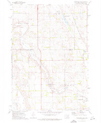
1973 Map of Wessington Springs
USGS Topo · Published 1976About this map
Wessington Springs stands as the central hub of Jerauld County, nestled at the foot of the prominent escarpment that defines this section of the James River Highlands. By the early 1970s, the town's infrastructure reflected both its frontier railroad history and its contemporary agricultural role, with the Chicago Milwaukee St Paul and Pacific line running east through the flats while the Old RR Grade hints at earlier transportation routes.
Find a feature on this map
24 named features on this map. Tap any name to fly to it.
Don’t see what you’re looking for? This feature index may not catch every label — zoom into the map to look around manually.
Map Details
Editions of this 1973 Wessington Springs Map
This is the sole edition of this map. No revisions or reprints were ever made.
Other maps of this area

1898 · Huron
USGS Topo · 1:125,000

1899 · Mitchell
USGS Topo · 1:125,000

1942 · Crow Lake
USGS Topo · 1:62,500

1953 · Huron
USGS Topo · 1:250,000

1954 · Huron
USGS Topo · 1:250,000

1955 · Mitchell
USGS Topo · 1:250,000

1959 · Mitchell
USGS Topo · 1:250,000

1973 · Wessington Springs NE
USGS Topo · 1:24,000

1973 · Wessington Springs NW
USGS Topo · 1:24,000
1973 · Woonsocket NW
USGS Topo · 1:24,000