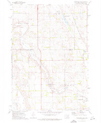
1973 Map of Woonsocket NW
USGS Topo · Published 1976About this map
Sand Creek and Firesteel Creek meander through the prairie landscape of Jerauld Co and Beadle Co in the early 1970s. This agricultural region is defined by its township structure, including Kellogg, Carlyle, and Dale, where the placement of section lines and gravel pits reflects the local economy. The Chicago Milwaukee St Paul and Pacific railroad tracks run along the eastern edge, serving the community of Alpena.
Find a feature on this map
16 named features on this map. Tap any name to fly to it.
Don’t see what you’re looking for? This feature index may not catch every label — zoom into the map to look around manually.
Map Details
Editions of this 1973 Woonsocket NW Map
This is the sole edition of this map. No revisions or reprints were ever made.
Other maps of this area

1898 · Huron
USGS Topo · 1:125,000

1951 · Wessington SE
USGS Topo · 1:24,000

1953 · Huron
USGS Topo · 1:250,000

1954 · Huron
USGS Topo · 1:250,000

1973 · Alpena
USGS Topo · 1:24,000

1973 · Wessington Springs NE
USGS Topo · 1:24,000
1973 · Woonsocket
USGS Topo · 1:24,000

1973 · Wessington Springs
USGS Topo · 1:24,000
1973 · Virgil
USGS Topo · 1:24,000
1973 · Wolsey SE
USGS Topo · 1:24,000