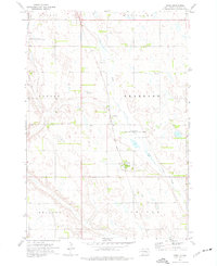
1973 Map of Virgil
USGS Topo · Published 1976About this map
Virgil and the surrounding agricultural townships of Vernon and Dearborn define this South Dakota prairie landscape in the early 1970s. The settlement pattern is anchored by the Chicago Milwaukee St Paul and Pacific railroad, which runs north-south through the center of the Beadle County countryside. The small community of Virgil is marked by its rail siding and a prominent Water Tank, serving as a local hub amidst a grid of section lines and fence rows.
Find a feature on this map
17 named features on this map. Tap any name to fly to it.
Don’t see what you’re looking for? This feature index may not catch every label — zoom into the map to look around manually.
Map Details
Editions of this 1973 Virgil Map
This is the sole edition of this map. No revisions or reprints were ever made.
Other maps of this area

1898 · Huron
USGS Topo · 1:125,000

1950 · Wessington NE
USGS Topo · 1:24,000

1951 · Wessington SE
USGS Topo · 1:24,000

1953 · Huron
USGS Topo · 1:250,000

1954 · Huron
USGS Topo · 1:250,000
1973 · Wolsey
USGS Topo · 1:24,000

1973 · Alpena
USGS Topo · 1:24,000

1973 · Wessington Springs NE
USGS Topo · 1:24,000
1973 · Broadland
USGS Topo · 1:24,000
1973 · Woonsocket NW
USGS Topo · 1:24,000