
1950 Map of Wessington NE
USGS Topo · Published 1950About this map
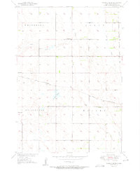
The prairie landscape of Beadle County is defined by the winding course of Cain Creek and the intricate wetlands around Bracken Slough and Norwegian Lake. This 1950 survey highlights the rural organization of the South Dakota plains, divided into townships such as Wessington, Wolsey, Whiteside, and Allen. The map reveals a community structured around scattered rural education sites, including Neeman Sch, Pault Sch, and Updike Sch, along with a centralized Town Hall. Transportation and water access are central to the area's development, evidenced by the convergence of the Chicago and North Western and the Chicago Milwaukee St Paul and Pacific railroads, alongside functional landmarks like a Windmill and a Flowing Well that supported the agricultural economy.
Find a feature on this map
15 named features on this map. Tap any name to fly to it.
Don’t see what you’re looking for? This feature index may not catch every label — zoom into the map to look around manually.
Map Details
Editions of this 1950 Wessington NE Map
3 editions found
Other maps of this area

1895 · Byron
USGS Topo · 1:125,000

1898 · Huron
USGS Topo · 1:125,000

1899 · Redfield
USGS Topo · 1:125,000

1950 · Wessington
USGS Topo · 1:24,000

1951 · Wessington SE
USGS Topo · 1:24,000

1951 · Wessington SW
USGS Topo · 1:24,000

1953 · Huron
USGS Topo · 1:250,000

1954 · Huron
USGS Topo · 1:250,000

1967 · Hitchcock SW
USGS Topo · 1:24,000

1967 · Tulare SE
USGS Topo · 1:24,000